Frontline visible on heat map due to reduced agricultural activity

Frontline visible on heat map due to reduced agricultural activity


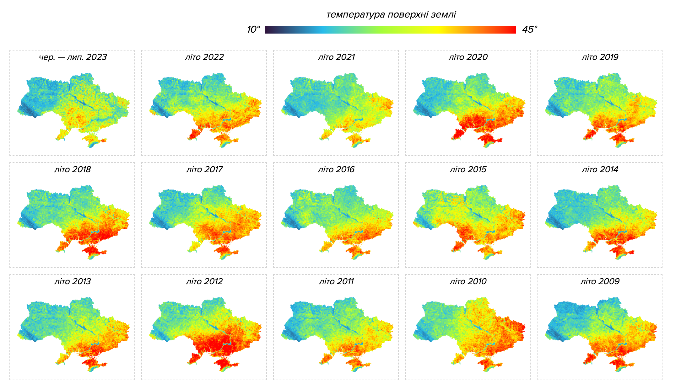
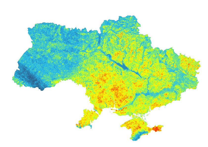
The massive line of the Russian-Ukrainian front is clearly visible on a heat map, TEXTY revealed. It can be presumed that in areas not occupied by agriculture, the land temperature is slightly lower compared to other cultivated lands.

The data from the MODIS satellite, which records land surface temperatures during the summer months starting from 2000, has been analyzed by TEXTY. Scientists use these indicators to assess climate change. The map of 2023 clearly delineates the front line. This is due to the fact that the land in war zone is not cultivated for agriculture. These areas are overgrown with grass and bushes, and consequently, they receive less solar radiation and thus stay cooler.

To suggest a correction or clarification, write to us here

You can also highlight the text and press Ctrl + Enter

Please leave your suggestions or corrections here


    Euromaidan Press

    We are an independent media outlet that relies solely on advertising revenue to sustain itself. We do not endorse or promote any products or services for financial gain. Therefore, we kindly ask for your support by disabling your ad blocker. Your assistance helps us continue providing quality content. Thank you!

    Related Posts

    Ads are disabled for Euromaidan patrons.

    Support us on Patreon for an ad-free experience.

    Already with us on Patreon?

    Enter the code you received on Patreon or by email to disable ads for 6 months

    Invalid code. Please try again

    Code successfully activated

    Ads will be hidden for 6 months.