The Institute for the Study of War (ISW) and the Ukrainian open-source intelligence mapping project Deep State confirmed recent Russian advances in Donetsk and Kursk Oblasts as fighting intensifies across multiple fronts.
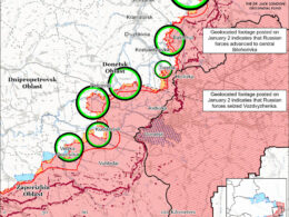
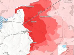
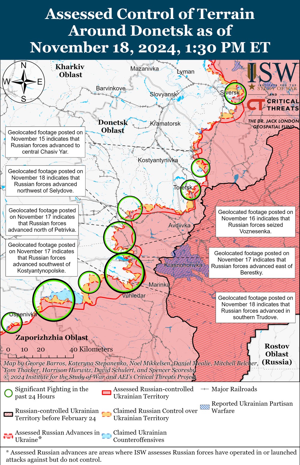
ISW reported that Russian forces continued offensive operations in Donetsk Oblast on 18 November, advancing in the Siversk, Pokrovsk, and Vuhledar directions.
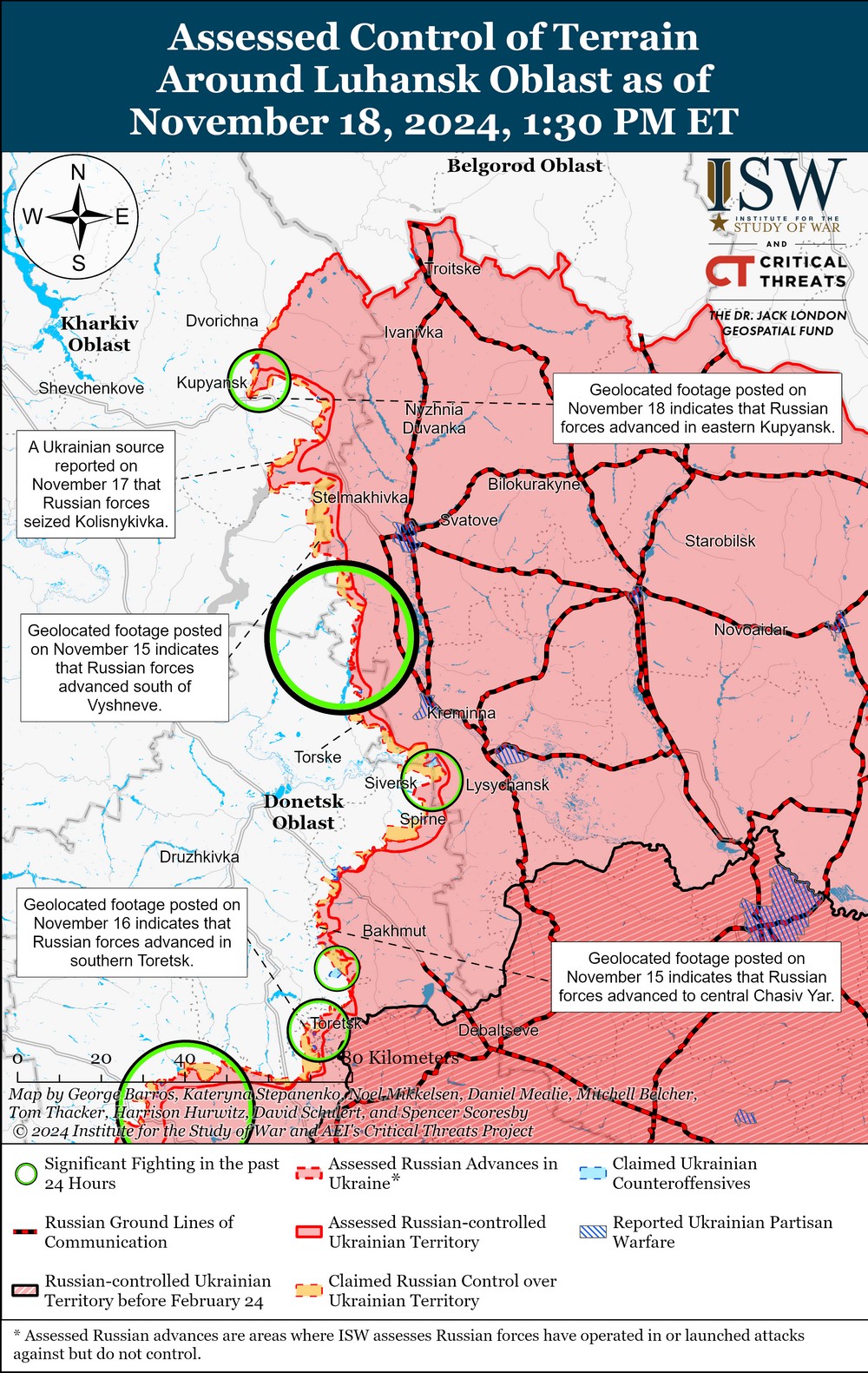
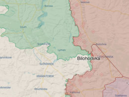
Geolocated footage published on 17-18 November confirmed movements south of Luhansk Oblast's Bilohorivka, northwest of Donetsk Oblast's Selydove, and within southern Trudove. The Russian Ministry of Defense claimed the capture of Novooleksiivka near Pokrovsk, which ISW had previously assessed as taken on 7 November.
In the Vuhledar direction, Russian forces advanced near Dalne and southwest of Kostiantynopolske. Geolocated footage showed platoon-sized mechanized assaults confirming progress in key areas, according to ISW.

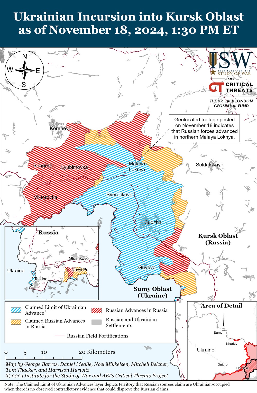
In Russia's Kursk Oblast, ISW noted Russian advances in the Malaya Loknya area, north of Sudzha, as of 18 November. Geolocated footage confirmed movement in northern Malaya Loknya during continued offensive operations.
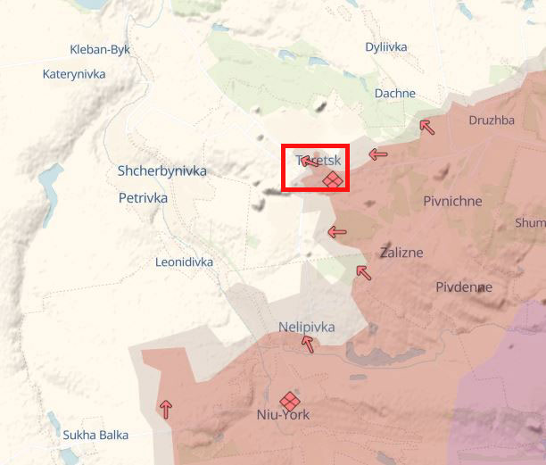
Deep State corroborated the Russian advancement in general locations mentioned in the ISW's report, identifying Russian progress in eight locations. In Donetsk Oblast, Russian forces advanced in Kalynivka, Toretsk, Kurakhove, Berestky, near Chasiv Yar, Yuriivka, and Rozdolne. Additionally, in Kursk Oblast, Russian troops gained ground near Pogrebki, accorfing to Deep State.


Related:
- ISW reports Kremlin threats over US approval of Ukrainian ATACMS strikes inside Russia
- Washington to announce extra defense aid for Ukraine in coming days, US UN envoy says
- Frontline report: Russian commanders’ lies about gains in Kursk Oblast leave soldiers trapped
- ISW: Ukraine’s Pokrovsk defense alters Russian plans to capture city
- Deep State: Russian forces gain ground in Chasiv Yar and near Kurakhove
- Russia launches only 11 explosive drones after yesterday’s massive attack
- Frontline report: Russians suffer high losses near strategic Terny due to poor planning and logistical challenges
- Deep State: Kurakhove remains epicenter of fighting, nearly 700 clashes in two weeks
- Forbes: Predictable Russian tactics in Kursk salient play into Ukrainian defenses
- Woman killed, ten injured in Russian air attack on Odesa, including nine-year-old child