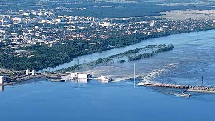
The destruction of the Kakhovka Hydroelectric Power Plant (KHPP) dam is significantly changing the geography and topography of the Kherson frontline sector in southern Ukraine. Near-infrared (NIR) imagery captured at 0400 am ET on 7 June indicates that the flooding is heavily disrupting Russian-prepared defensive positions on the east (left) bank of the Dnipro River – especially affecting Russian first-line positions in Hola Prystan and Oleshky.
Various sources (1; 2; 3; 4; 5
; 6; 7; 8; 9; 10; 11) reported that Oleshky, Hola Prystan, Kozachi Laheri, and Dnipryany are almost entirely flooded with water levels rising to the height of a one-story buildings in some areas.
The Ukrainian headquarters established to remediate the consequences of the dam’s destruction reported that as of 7 June, 29 settlements are partially or fully flooded, 19 of which are located on the Ukrainian-controlled territory and 10 on Russian-occupied territories.
Russian sources
published footage indicating that water had begun receding in Nova Kakhovka and had dropped by 30cm. Russian sources also claimed that water levels decreased by three to four meters in some areas from a high of 10 meters. Water levels in nearby Mykolaiv City reportedly increased by 70cm as of June 7.
Flooding will likely worsen and further change the geography in Kherson Oblast over the next 72 hours (the report describes events as of 7 June evening, - Ed.).
Infrared satellite images showing Ukraine's Dnipro river before and after the Kakhovka dam breach have been gathered by BBC Verify team.https://t.co/EjyFUG2bzW pic.twitter.com/sTYeFIVEI3
— Euromaidan Press (@EuromaidanPress) June 8, 2023
The destruction of the KHPP dam is affecting Russian military positions on the eastern bank of the Dnipro River. The flooding has destroyed many Russian first line field fortifications that the Russian military intended to use to defend against Ukrainian attacks. Rapid flooding has likely forced Russian personnel and military equipment in Russian main concentration points in Oleshky and Hola Prystan to withdraw. Russian forces had previously used these positions to shell Kherson City and other settlements on the west (right bank) of Kherson.
Ukrainian Southern Operational Command Spokesperson Nataliya Humenyuk stated that Russian forces relocated their personnel and military equipment from five to 15 kilometers from the flood zone, which places Russian forces out of artillery range of some settlements on the west (right bank) of the Dnipro River they had been attacking.
The flood also destroyed Russian minefields along the coast, with footage showing mines exploding in the flood water.
Kherson Oblast Occupation Head Vladimir Saldo, however, claimed that the destruction of the KHPP is beneficial to the Russian defenses because it will complicate Ukrainian advances across the river. Saldo’s assessment of the situation ignores the loss of Russia’s first line of prepared fortifications. The amount of Russian heavy equipment lost in the first 24 hours of flooding is also unclear.
Ukrainian officials continued to accuse Russian forces of destroying the KHPP dam out of fear that Ukrainian forces would land on the east (left) bank Kherson Oblast.
Read also:
- Russians shelling Kherson’s evacuation site as people being rescued from flooded homes (photos)
- Kakhovka Dam was built to withstand nuclear strike, couldn’t be destroyed from outside – Ukrhydroproject engineering company
- Destruction of Kakhovka Dam continues, reservoir water levels keep declining – Ukrhydroenergo
- Russians blew up Kakhovka Dam using explosives planted there last fall – Danilov


