As Ukraine's allies delay delivering weapons capable of destroying the Russian-built Crimean Bridge, like the German Taurus missile, Russia is swiftly building alternative railway links for its forces in the occupied south of Ukraine, according to Texty.
Russian military logistics, crucial for the Russian Armed Forces, heavily rely on rail transportation, which serves as the primary means for troop and heavy weapon movement. Russia even maintains a dedicated branch, known as the railway troops, to support this logistics network.
Last September, Petro Andriushchenko, advisor to Mariupol’s exiled mayor, stated that Russian occupiers were constructing a direct railroad connection to Mariupol, Volnovakha, and Donetsk. If completed, this railroad would link the Mariupol-Aslanove-Kalchyk-Volnovakha branch in occupied Ukraine with the Russian cities of Taganrog and Rostov-on-Don.
Russia builds new railway to connect Crimea to mainland Ukraine’s occupied Mariupol, Donetsk
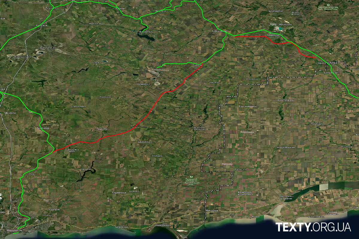
Andriushchenko shared a map highlighting planned Russian railway routes. Texty's satellite image analysis revealed a key segment, near Hranitne northeast of Mariupol, marked in red, from Burne to Malovodne, approximately 60 km long, is likely near completion, contrasting with the existing network marked in green:

Construction of this railway segment likely started in summer 2023, as evidenced by a Sentinel-2 satellite image from August 2023, which shows the early stages of work with the new railway line ending abruptly after its beginning.

The railway line connecting Burne and Malovodne is now included in the Open Street Map database, which is updated and maintained by a community of volunteers.
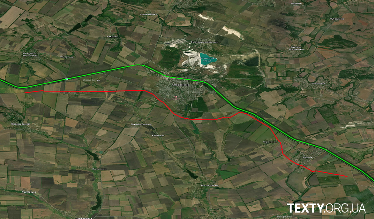
Texty detected a new road segment on satellite images, running south from Amvrosiivka toward the Russian border (red line). While it's unclear if this is a railway, as it's less visible on the Sentinel-1 radar image compared to the Burne-Malovodne section, it's definitely a recently constructed path not previously recorded by satellites. The existing railway north of Amvrosiivka is marked in green. The length of this railway segment is approximately 20 km.

This is a map with both lines, the total length of which may exceed 80 km:

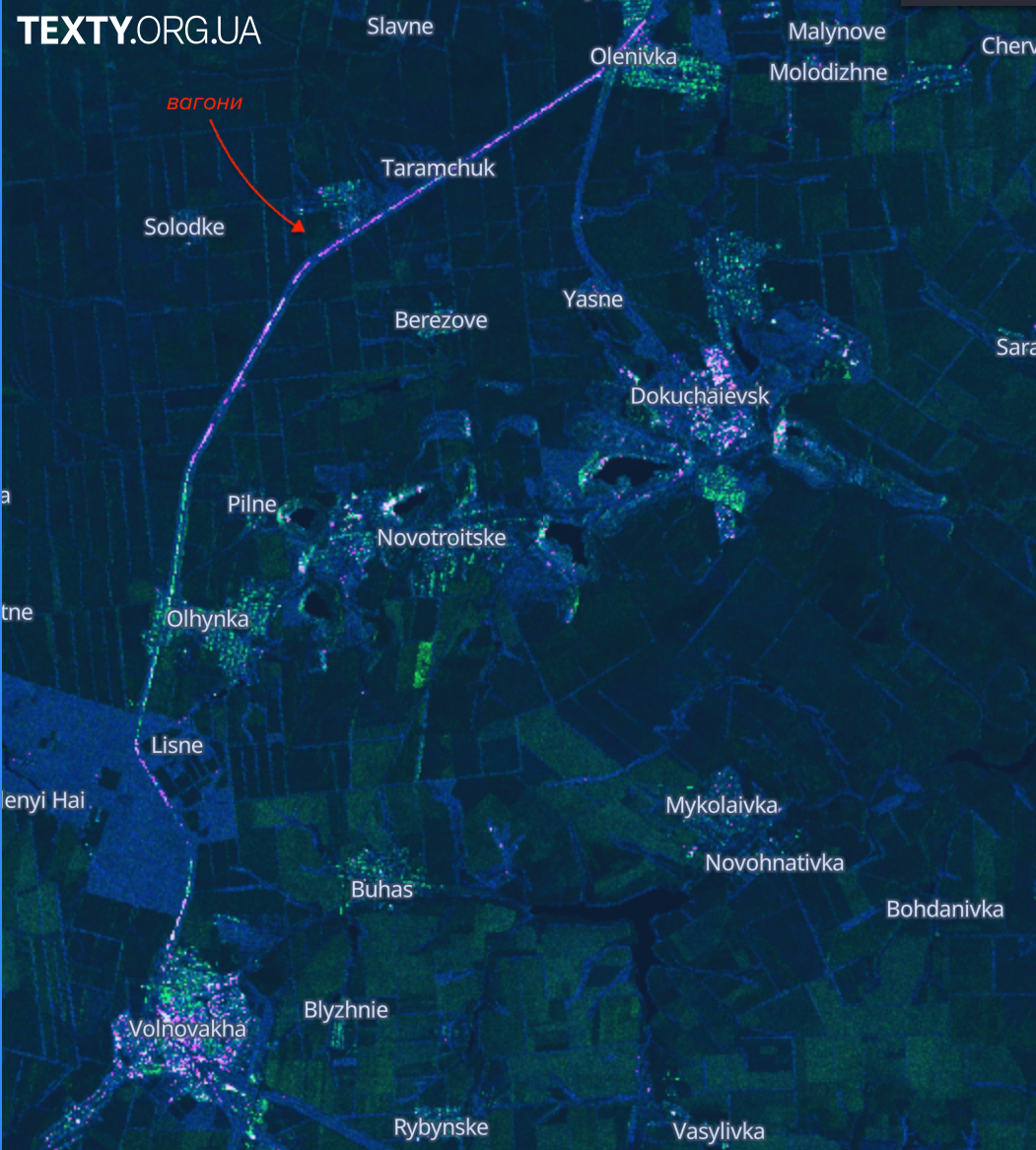
Additionally, since summer 2023, the Russians have built a 30-kilometer-long barrier using over 2,000 railcars in the occupied area to the north from the lines shown above. Experts believe this metal structure serves as a defensive line, though its effectiveness is debatable. Its purpose is to obstruct the advancement of Ukrainian forces.
The occupiers' structure is evident on the Sentinel-1 radar satellite, appearing as a curved green-pink line between Donetsk Oblast's Olenivka and Volnovakha in the image below.

Sentinel-1 satellite imagery reveals heightened activity near Vesela village, close to the new railway line, according to @Schizointel on X (formerly Twitter).
Footage from the occupied part of Donetsk Oblast published in February shows the railway construction works:
‼️ Русня готується до можливої втрати Кримського мосту...
«А у нас залізницю будують. Буде поїзд на Крим ходити».,
- каже авторка відео.Керченській міст скоро вже буде не потрібен, потяги до Криму будуть їздити через окуповані території. pic.twitter.com/1Z84q1tih0
— Генсек НАТО (@ANDRU6307) February 27, 2024
The Russians also carry out railway repairs in the occupied part of Luhansk Oblast. The photos published last November show the repair works on a railway stretch between Pervomaisk and Zolote in the area of Popasna:
https://twitter.com/rusnia_idenahui/status/1729520225387720998
Read also:
- UK intel: Railway sabotage challenges Russian military’s supply chain logistics
- Russia builds new railway to connect Crimea to mainland Ukraine’s occupied Mariupol, Donetsk
- Russian logistics to suffer short- and medium-term after Crimean bridge attack – ISW
- Ukraine reports strike on Chonhar bridge, connecting Crimea with southern Ukraine
- Railway partisans: Crimea’s rail connection with mainland occupied Ukraine targeted in string of attacks


