Copyright © 2021 Euromaidanpress.com

The work of Euromaidan Press is supported by the International Renaissance Foundation

When referencing our materials, please include an active hyperlink to the Euromaidan Press material and a maximum 500-character extract of the story. To reprint anything longer, written permission must be acquired from [email protected].

Privacy and Cookie Policies.

Russian troops trying to restore crossing near Kakhovka power plant, satellite imagery shows

Sep 18 Planet Labs satellite photo showing the canal south of the Kakhovka Hydroelectric Power Plant. Photo: Twitter/@cxemu
Russian troops trying to restore crossing near Kakhovka power plant, satellite imagery shows

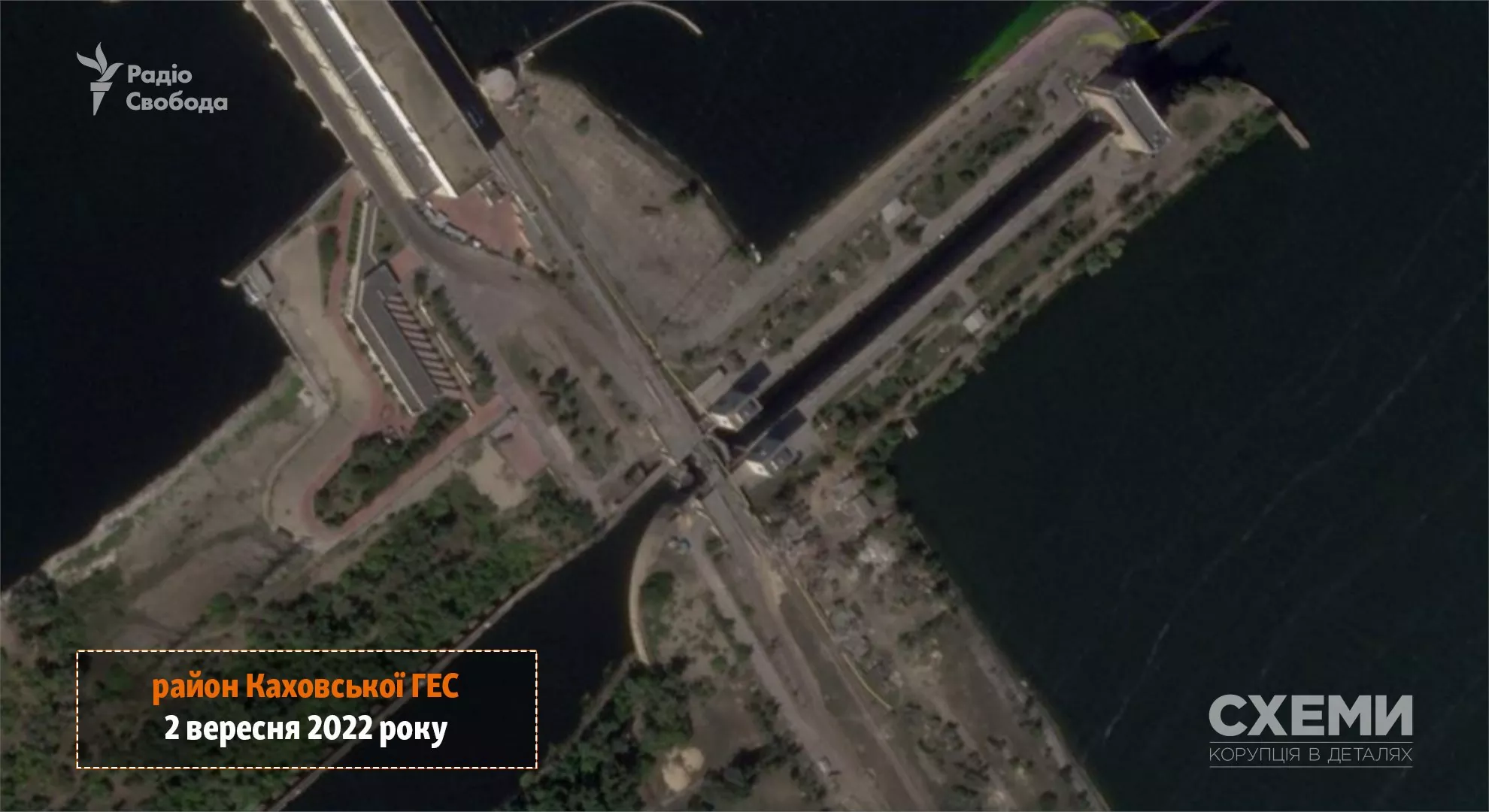
Planet Labs satellite images show the attempts of the Russian forces to re-establish the crossing at the lock bridge in the area of ​​the Kakhovka hydroelectric plant in the occupied part of Kherson Oblast, according to RFE/RL’s project Skhemy.

The Armed Forces of Ukraine had destroyed the vehicular bridge over the lock canal and severely damaged the railway bridge next to it near the plant by hitting those using the HIMARS multiple rocket launchers on several occasions. Other Ukrainian strikes damaged the vehicular dam bridge across the Dnipro river next to the lock bridge.

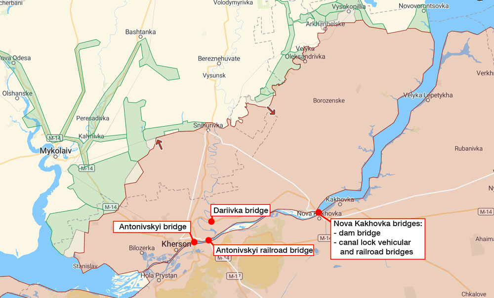
These bridges are one of three major crossings over the Dnipro river for the Russian grouping of forces concentrated on the western left bank of the Dnipro. All three have been damaged as part of the ongoing war of attrition in the area, which significantly complicated Russia’s attempts to transfer supplies and reserves to the west of the Dnipro.

Key bridges in Kherson Oblast. Map: Euromaidan Press, based on the DeepState map.

The photos from September 18 show an embankment under the damaged part of the bridge and previously sunk railcars, Skhemy wrote.

Sep 18 Planet Labs satellite photo showing the canal south of the Kakhovka Hydroelectric Power Plant. Photo: Twitter/@cxemu

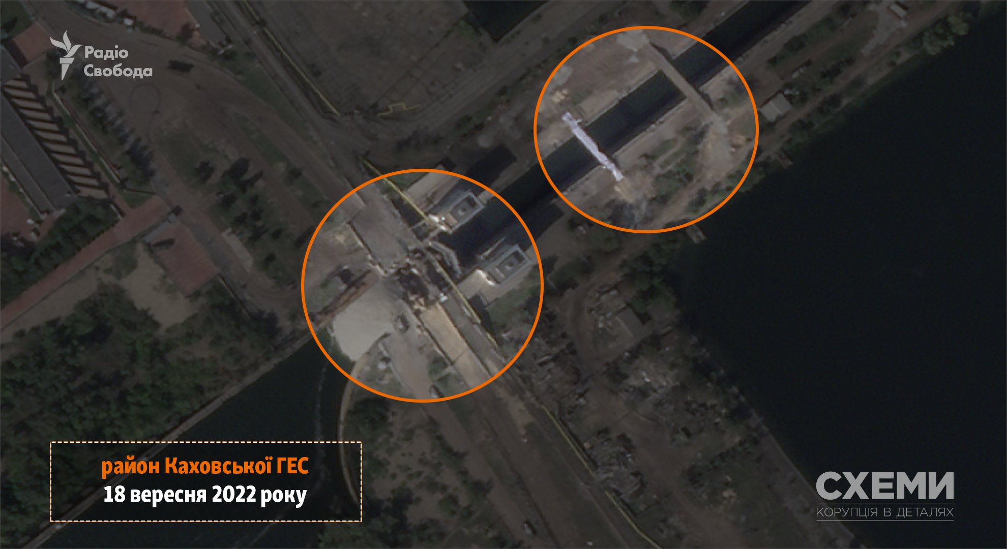
The imagery confirms the report from the General Staff of Ukraine’s bulletin dated September 17 stating that the Russian forces had sunk nine rail cars in the canal to rebuild the crossing near the Kakhovka power plant.

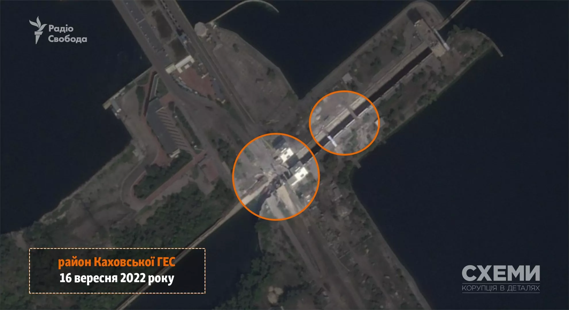
The September 16 satellite photo available to Skhemy shows the location where the wagons were sunk. At the same place, the embankment appeared later.

Sep 16 Planet Labs satellite photo showing the canal south of the Kakhovka Hydroelectric Power Plant. Photo: Twitter/@cxemu

Also, Planet Labs imagery shows smaller crossings nearby, on the other side of the Kakhovska power plant. Those are absent from September 2 imagery.

Sep 2 Planet Labs satellite photo showing the canal south of the Kakhovka Hydroelectric Power Plant. Photo: Twitter/@cxemu


You could close this page. Or you could join our community and help us produce more materials like this.  We keep our reporting open and accessible to everyone because we believe in the power of free information. This is why our small, cost-effective team depends on the support of readers like you to bring deliver timely news, quality analysis, and on-the-ground reports about Russia's war against Ukraine and Ukraine's struggle to build a democratic society. A little bit goes a long way: for as little as the cost of one cup of coffee a month, you can help build bridges between Ukraine and the rest of the world, plus become a co-creator and vote for topics we should cover next. Become a patron or see other ways to support. Become a Patron!

To suggest a correction or clarification, write to us here

You can also highlight the text and press Ctrl + Enter

Please leave your suggestions or corrections here


    Related Posts