Since the full-scale invasion began in February 2022, Russia has placed 150 new satellites into low Earth orbit, bringing its total LEO constellation to 253 spacecraft, according to data compiled by Ukrainian investigative outlet Texty using CelesTrak tracking records.
The satellites circle the planet at altitudes where surface detail is sharpest and radio signals travel fastest — and their orbits mean Ukrainian territory can be scanned dozens of times per day, Texty reports.
"Blind zones barely exist," the outlet notes. "Every Russian satellite will sooner or later fly over Ukraine. The only question is when exactly and what it will manage to see."
What the fleet consists of
Of the 253 satellites, Texty identifies 54 as military communications spacecraft providing encrypted data links between command structures and combat units. Twelve are classified as ELINT — electronic intelligence platforms that intercept radar emissions, radio communications, air defense signals, and other electronic traffic. Seven carry optical reconnaissance cameras capable of resolving objects as small as 0.3 meters across.
Four satellites are listed as technology demonstrators, some of which, Texty notes, "display suspicious maneuverability that may indicate a military purpose." The remaining 165 — nearly two-thirds of the total — have no verified open-source data on their function. "Russia often launches dual-purpose satellites under the guise of 'scientific' or 'civilian' missions, concealing their actual capabilities," the report states.
Texty also flags two categories absent from its main visualization. GLONASS navigation satellites, which operate at higher altitudes, are the system used to guide Russian missiles and drones. And Russia likely possesses at least one SAR satellite — a synthetic aperture radar platform that images through cloud cover and in any weather, comparable to the ICEYE spacecraft that Ukrainian fundraiser Serhiy Prytula helped acquire for Kyiv. "According to experts, Russia has at least one such satellite, even if it does not advertise the fact," the report says.
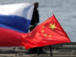
China's 1,094
Russia does not operate alone in orbit. Texty reports that Moscow draws on imagery and signals data from China, its "strategic partner," whose low-orbit constellation stands at 1,094 satellites — more than four times Russia's own. The outlet highlights Chinese optical and electronic intelligence spacecraft in its visualization as assets effectively available to Russian targeting.
"We are constantly within the field of view of Russian and Chinese satellites," Texty states. "When Russia's own capacity is insufficient, it purchases imagery from Western commercial satellite companies."
Predictable orbits, countermeasures
The report, drawing on assessments from Ukraine's National Security and Defense Council specialists and military analysts, outlines several countermeasures. The most practical, sources tell Texty, is the use of decoys: "From hundreds of kilometers up, a satellite often cannot distinguish a skillfully made mockup from a real target. As a result, the enemy will spend missiles destroying dummies."
Orbital mechanics also work in defenders' favor. Because satellite trajectories are fixed and predictable, forces can time equipment movements and position changes to the gaps between overpasses — or exploit periods of heavy cloud cover, which blinds optical cameras, though not SAR radar.
Texty notes a structural limitation on satellite intelligence for fast-moving battlefield decisions: "Data from satellites is more about large concentrations of equipment and troops, major logistics routes, military production facilities that can be calculated by tracking vehicle movement, or analysis of strikes on energy infrastructure." For real-time targeting, Russian forces rely primarily on reconnaissance drones rather than orbital assets.
Methodology
Texty's analysis covers the period January 10–17 for its overpass simulation, tracking all 253 satellites across Ukrainian territory. Swath-width data — the ground coverage strip each satellite can observe in a single pass — was sourced from the Union of Concerned Scientists, though the outlet notes that precise figures are unavailable for many spacecraft. Satellite positions are drawn from CelesTrak's live catalog.
Read also
-
Zelenskyy says Iran war is delaying Ukraine peace talks and depleting missile stocks
-
After a winter of blackouts, Ukraine and the EU stockpile energy repair equipment before Russia strikes again
-
Ukraine deploys 201 drone specialists to the Gulf – the same Shaheds hitting the Middle East have hit Kyiv since 2022