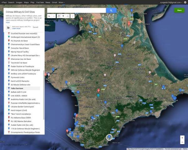
 An an open-source map designed to help spread accurate, timely information about the Russian occupation of Crimea has been released. Data is drawn from various open and private sources. The author asks to contribute what you know.
Some precise locations are unknown. The status of many sites are uncertain and in flux. Updates are made frequently. Help with compatibilty to other mobile devices would be appreciated.
Ukrainian sites are marked in blue, Russian sites in Red. Grey points are abandoned military sites.
This map is created and maintained by "Paul Szegedin" (a pseudonym) at [email protected], is be permanently available at euromaidan.wordpress.com and is also found at occupiedcrimea.blogspot.com