The exhibition titled “The Refugee Experience: The Fate of Refugees from the Territory of the Former Russian Empire in Interwar Czechoslovakia” recently opened at the Hvězda Pavilion, a picturesque park located on the outskirts of Prague.

The exhibition shows the life of emigrants from Ukraine, Russia and Belarus who fled to Czechoslovakia in the interwar period.
The emigration movement in 1918 was predominantly political and triggered by several political upheavals - the rise and fall of the Ukrainian liberation movement in 1917-1921, the defeat of the Belarusian People’s Republic, and the unsuccessful advances of the Russian White Movement against the Bolsheviks.
Czechoslovakia was then a democratic state, and President Tomáš Masaryk opened the country’s doors to political immigrants. These diaspora groups grew and flourished as various clubs, cultural and scientific institutions were created. A total of two million people, fleeing from Bolshevik persecution and the wars, left the former territories of the Russian Empire and settled in different European countries.
“In the early 1920s, the young Czech state helped many immigrants from the former Russian Empire, and also supported each diaspora’s educational institutions. Ukrainian immigration was very strong in Czechoslovakia, and some institutions moved here from Vienna – for example, the Ukrainian Free University.” says the curator of the exhibition, Jakub Hauser.
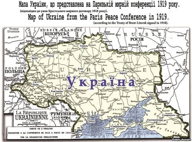
A unique and very rare map of Ukraine is displayed at the exhibition. It shows Ukraine’s struggle to preserve its statehood during the UNR period and the voracious appetites of Ukraine’s neighbours.
“At the turn of 1920, many European countries were finally at peace, but not Ukraine. Look at the ironic title of the map – “World Peace in Ukraine!” - suggesting that although peace reigned in many European countries after the First World War, this was far from true in Ukraine. The situation in Ukraine contrasted greatly with Czechoslovakia’s, which had already managed to rebuild a young state. But, Ukraine was on fire, and the Ukrainian state managed to stay afloat for only a very short period of time.” says Hauser.
The map shows Bolsheviks encroaching on Ukrainian territories from the north, the White Guards advancing from the east as flames devour the country.

“On the map, we can see both the Bolsheviks and the White Guards under the Tsar’s flag fighting against Ukraine. It’s interesting that the Bolsheviks and the White Guards fought against each other, but they united their forces to fight against Ukraine - Ukraine was in a very difficult situation then!” explains Hauser.
The map shows Ukraine’s neighbours in the west and the southwest – Romanian and Polish soldiers - also eyeing Ukrainian territories.

The map was published in Vienna by Christoph Reisser and Sons almost a hundred years ago, either in 1919 or in 1920. The artist is called “Verte”, and the map was obviously created in Vienna, because next to his signature in the lower right corner is the inscription “Wien”. The author of the map - that is, the author of the concept – is Y. Hasenko. The map is stored in the Slavic Library in Prague.

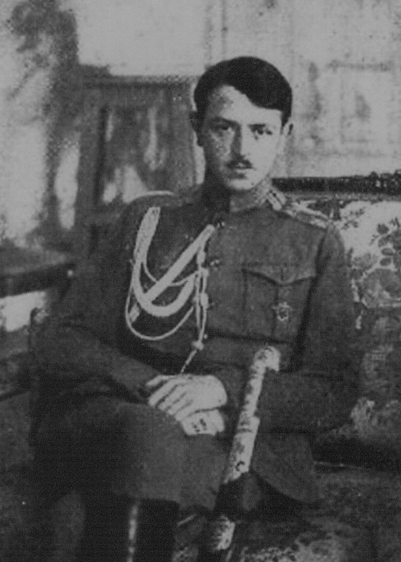
Yuriy Hasenko was a political and cultural figure in the UNR. He was also personal Adjutant General Secretary of Military Affairs to Symon Peytliura (Ukrainian statesman, politician and nationalist leader who led Ukraine's struggle for independence following the
Russian Revolution of 1917 (1918–1921)-Ed) and member of the Ukrainian Central Council delegation at the peace talks in Brest.
Hasenko was also a special envoy of the UNR Ministry of Foreign Affairs, assigned to various diplomatic missions in Austria, Germany, Italy, Switzerland, etc. Therefore, he was well versed in politics and the complicated situation that surrounded Ukraine in those difficult years.
Hasenko worked at the UNR Embassy in Romania, also lived in Czechoslovakia and Germany, and finally moved to France, where he died in the early 1930s.
“The map illustrates the tragic history of Ukraine in those days. But, it speaks to us in another way…. referring to the current situation in Ukraine. Because of various imperialist aspirations of other countries, Ukraine was unable to maintain an independent state.” says Hauser.
The map also reflects the current situation in Ukraine where Russian forces have occupied Ukrainian territories for well over three years.

There are also certain parties and politicians in neighbouring western countries that have announced their plans to return specific Ukrainian regions under their control, or demanded autonomy for territories inhabited by close ethnic communities.
“Of course, it’s very difficult to compare the situation that existed 100 years ago with the present one. For example, relations between Ukraine and Poland at that time were much more complicated than today. But, if we look at Russia’s current aggression against Ukraine, then in some respects, history is being repeated.” says Hauser.
Professor Jiri Pehe of Columbia University (USA) points out that the key reason for Ukraine’s failure to maintain its statehood 100 years ago was the lack of support from all the leading Western powers.
“Western support is very important. Unlike the countries that were part of the Austro-Hungarian Empire and had some autonomy, Ukraine had nothing under the Russian Empire and therefore, wasn’t prepared to assume statehood at that time.” says Pehe.

Although there were many reasons for the defeat of the Ukrainian liberation movement 100 years ago, such as the lack of unity among Ukrainians or a strong focus on leftist social demands, less attention devoted to statehood itself, the absence of a powerful army during the UNR period, Professor Pehe points to the external factor as the most important catalyst in the ensuing events.

“These are lessons from past history, which are very relevant today! If a country wants to succeed and be independent, it must build strong alliances with leading world powers, as well as with its neighbours. If a country doesn’t have any support from powerful allies, then its independence may be threatened.” says Pehe.
“Ukraine is in a different situation than 100 years ago because, despite Russia’s pressure, Ukraine has the support of Western Europe and the EU. In my opinion, this support and assistance should be stronger so that present-day Ukraine doesn’t suffer the same fate as Ukraine in 1917-1919.” concludes Professor Pehe.


